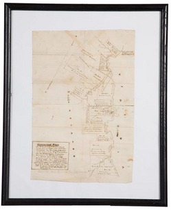
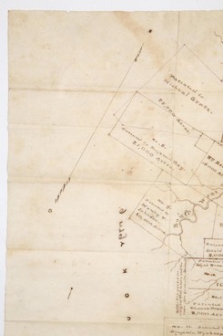
 | | Kentucky Big Sandy River map for the Philadelphia Company, hand-drawn 1785 map based on the survey by Wm. Alexander; image credit on full record. |
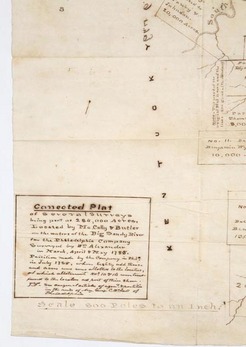 | | Kentucky Big Sandy River map for the Philadelphia Company, caption reading Connected Plat of several surveys being part of the 284,000 acres, Located by McCully & Butler on the waters of the Big Sandy River...April & May 1785; image credit on full record. |
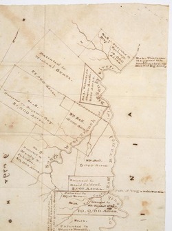 | | Kentucky Big Sandy River map for the Philadelphia Company showing lands are on the west side of the river; image credit on full record. |
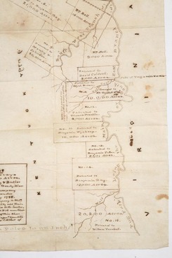 | | Kentucky Big Sandy River map for the Philadelphia Company showing lands are on the west side of the river, additional view; image credit on full record. |
 | | Kentucky Big Sandy River map for the Philadelphia Company showing lands are on the west side of the river, additional view; image credit on full record. |
|
Find Current Values for your Antiques!
Map; Philadelphia Company, Kentucky, Big Sandy River, 1785, Hand-Drawn, 16 inch.
1785 hand-drawn Kentucky map, Connected Plat of several surveys being part of the 284,000 acres, Located by McCully & Butler on the waters of the B... [more detail available via subscription]
p4A Item D9757235
|
Category: |
ephemera |
|
Origin: |
Kentucky |
|
Type: |
maps, globes & charts |
|
Year: |
1785 |
Learn more about this item:
 |
Auction Sales History |
|
Pre-Sale Value |
|
Condition |
 |
 |
Provenance |
|
Reference Notes |
|