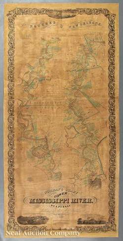
 | | A map by Marie Adrien Persac titled and dated Norman's Chart of the Lower Mississippi River from Natchez to New Orleans, 1858; image credit on full record. |
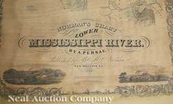 | | The title block on the Lower Mississippi River map by Marie Adrien Persac; image credit on full record. |
 | | An example of vignettes and the border on the Marie Adrien Persac Lower Mississippi River map; image credit on full record. |
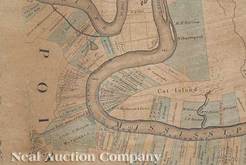 | | A detail of the Marie Adrien Persac Lower Mississippi River map showing land divisions and plantations; image credit on full record. |
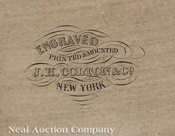 | | The J.H. Colton & Co. engraver's mark on the Marie Adrien Persac Lower Mississippi River map; image credit on full record. |
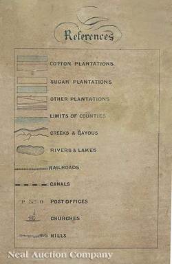 | | The legend on the Marie Adrien Persac Lower Mississippi River map; image credit on full record. |
 | | A portion of the title block showing the year 1858; image credit on full record. |
|
Find Current Values for your Antiques!
Map; Persac (Marie Adrien), after, Norman's Chart of the Lower Mississippi River..., 1858, 62 inch.
After Marie Adrien Persac (French, Louisiana, 1823 to 1873), Norman's Chart of the Lower Mississippi River from Natchez to New Orleans, ... [more detail available via subscription]
p4A Item E8998184
|
Category: |
ephemera |
|
Origin: |
Louisiana |
|
Type: |
maps, globes & charts |
|
Year: |
1858 |
Learn more about this item:
 |
Auction Sales History |
|
Pre-Sale Value |
|
Condition |
 |
|
Provenance |
|
Reference Notes |
|