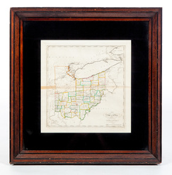
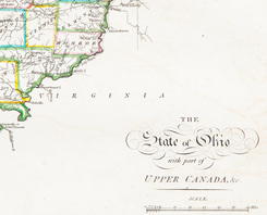
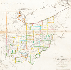
A circa 1820s map of Ohio probably from a Matthew Carey atlas; image credit on full record.
image credit on full record.
image credit on full record.
image credit on full record.
Find Current Values for your Antiques!
Map; Carey (Matthew), State of Ohio with part of Upper Canada, ca 1825, Engraving, Hand Colored.
A map of Ohio probably from a Matthew Carey atlas, ca.1820s. Hand-colored engraving on laid paper of "The State of Ohio with part of Upper Canada".
... [more detail available via subscription]