Search Results
| There are
610 records in our database matching your search criteria. Page [PREV PAGE] 1 2 3 4 5 6 7 8 9 10 11 12 13 14 15 [Next PAGE] [NEXT 15 PAGES] |
| You may click any of the images below to view the details for that record. |

Map; War Department, New Mexico Territory & Military Departments, 1867, 34 inch. |

Map; Mitchell (S Augustus), Mitchell's New National Map..., 1856, Wall, 64 inch. |

Map; Gaston & Johnson, United States, Present & Prospective, 1855, Wall, 66 inch. |
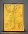
Map; Colton (JH), New Map of Palestine...Drawings of Robinson & Smith..., 1856, Wall, 44 inch. |

Map (2); Colton (GW & CB), Lake Superior to the Pacific Ocean, Northern Pacific RR, 1867, 45 inch. |

Flag; US, 38-Stars, Garrison, 20 ft. |

Map; Lloyd & Co, Lloyd's New Military Map of the Border & Southern States, 1862, 41 inch. |

Map; Bufford (JH), Genl Sherman's Campaign War Map, 1864, 24 inch. |

Map; Bien (Julius), Civil War Era, United States Military Rail Roads, 1866, 38 inch. |

Map; Case & Co, Map of the Seat of War...the American Conflict, 1866, 36 inch. |

Map; Harrison (John), Map of Louisiana from D'Anville's Atlas, 1788, 19 inch |

Map; Von Humboldt (Alexander), Mexico, Carte du Mexique et des Pays..., 1811, 28 inch. |

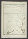
Map; Collot (Georges Henri Victor), Chart of the Sources of the Mobile and of the River Yazoo..., 1826, 24 inch. |

Map; Collot (Georges Henri Victor), Chart of the Sources of the Mobile and of the River Yazoo..., 1826, 24 inch. |
Map; Mitchell (John), A Map of the British and French Dominions in North America, 1760, 26 inch. |

Map; Jefferys (Thomas), Plan of New Orleans the Capitol of Louisiana, 1759, 19 inch. |