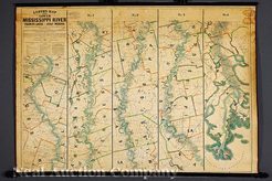
 | | A James T. Lloyd Publisher Lloyd's Map of the Lower Mississippi River from St. Louis to the Gulf of Mexico dated 1863; image credit on full record. |
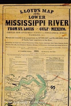 | | The title block and text; image credit on full record. |
 | | The lower margin and text; image credit on full record. |
 | | The Lloyd's Map of the Lower Mississippi River from St. Louis to the Gulf of Mexico; image credit on full record. |
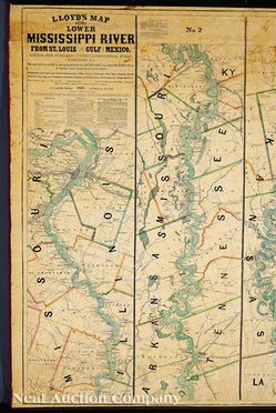
 | | The Lloyd's Map of the Lower Mississippi River from St. Louis to the Gulf of Mexico; image credit on full record. |
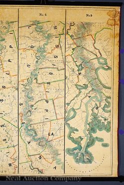 | | The Lloyd's Map of the Lower Mississippi River from St. Louis to the Gulf of Mexico; image credit on full record. |
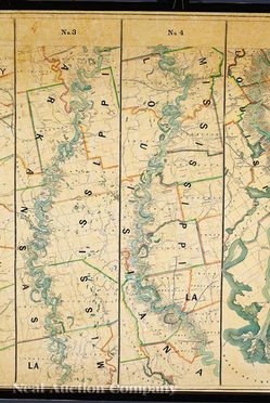
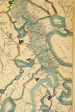 | | The Lloyd's Map of the Lower Mississippi River from St. Louis to the Gulf of Mexico; image credit on full record. |
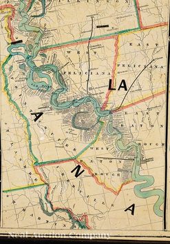 | | The Lloyd's Map of the Lower Mississippi River from St. Louis to the Gulf of Mexico; image credit on full record. |
|
Find Current Values for your Antiques!
Map; Lloyd (James T), Mississippi River, St Louis to Gulf of Mexico, 1863, 54 inch.
James T. Lloyd Publisher, Lloyd's Map of the Lower Mississippi River from St. Louis to the Gulf of Mexico..., 1863, New York, hand-color... [more detail available via subscription]
p4A Item E8874307
|
Category: |
ephemera |
|
Origin: |
New York |
|
Type: |
maps, globes & charts |
|
Year: |
1863 |
Learn more about this item:
 |
Auction Sales History |
|
Pre-Sale Value |
 |
Condition |
 |
|
Provenance |
|
Reference Notes |
|