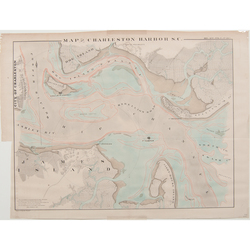
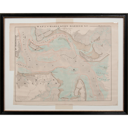
 | | A circa 1860 map or chart of the Charleston Harbor by Bowen & Co.; image credit on full record. |
 | | image credit on full record. |
|
Find Current Values for your Antiques!
Map; Bowen & Co, Map of Charleston Harbor SC, ca 1860, Colored, 25 inch.
Bowen & Co. Map of Charleston Harbor S.C., American, ca. 1860. View of Charleston Harbor describing water depths. Includes Forts Johnson, Sumter, Moul... [more detail available via subscription]
p4A Item F7910111
|
Category: |
ephemera |
|
Origin: |
Pennsylvania |
|
Type: |
maps, globes & charts |
|
Year: |
1855 - 1865 |
Learn more about this item:
 |
Auction Sales History |
|
Pre-Sale Value |
 |
Condition |
 |
|
Provenance |
|
Reference Notes |
|